FLOOD PLAIN, SOILS, AND LAND USE MAPS
The Bull Run Watershed
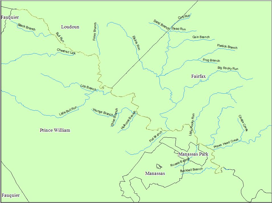
Bull Run, a perinatal tributary of the Occaquan river located in Loudoun, Prince William, and Fairfax counties, Virginia. The approximately 28 mile stream includes a watershed that covers approximately 50,000 hectares land. Streams are useful and beautiful natural resource features that provide a number of economic and ecological benefits. One major benefits of streams is the removal of stormwater, however during storm events rivers, streams and even small tributaries can flood their banks and damage infrastructure and buildings. This post will review Federal Emergency Management Agency (FEMA) flood maps in order to identify areas pron to flooding and determine if land use decisions are properly considering flood risks.
The 100 Year Flood
FEMA is an agency of the United States Department of Homeland Security tasked with coordinating the response to a disaster that has occurred in the United States and that overwhelms the resources of local and state authorities. FEMA established the National Flood Insurance Program (NFIP) is a Federal program enabling property owners in participating communities to purchase flood insurance as protection against flood losses, while requiring State and local governments to enforce floodplain management regulations that reduce future flood damages. FEMA has thus created numerous productive models most notably the 100 year flood plain map. The 100-year flood plain map an attempt to map the the area impacted by a flood that statistically has a 1-percent chance of occurring in any given year. The storm event that create a 100-year flood is considered a 100-year storm. Areas within flood plains must be managed and development within these areas must evaluate the risk of doing so.
The Bull Run Watershed has two major areas of extensive flooding rick one in located north west of the Manassas Park city and the other in west Fairfax county along Cub Run. The area of Bull Run that has a major area of only estimated (orange) 100 year flood plan is located in the Bull Run Regional park and in the Bull Run National Battlefield. These two parks consist of primary greens spaces including fields, forested, and pasture. The low presence of development means that few areas are at risk of flood damage. The areas south near Flat Branch are at a grater rick of receiving damaging floods. The area in Fairfax county along Cub Run is more developed with fewer buffer spaces like parks and more impermeable surfaces. Fairfax is Virginia's most populated county and dense development has lead to frequent flooding of stream banks.

Land Use
Land use is an important part of land management and flood prevention/risk. Areas pron that flood frequently or areas that have no record of flooding can be altered by land use divisions. Cutting down a forest could lead to erosion and flooding. Creating a wetland buffer could decrease the rate of infiltration and runoff reducing flood risk. A major issue facing the Bull Run watershed and the D.C. metropolitan area is the high density of urban development and the water resource issues that development creates.
Bull Run and its tributaries flow through a wide verity of land use/ land cover types. Bull Run flows through majority permeable surfaces (i.e. forest, pasture, agriculture, ect...). Located within the National Battlefield and Regional Park area there is a large wetland system that maybe why the area is mapped as a flood risk. The topography is likely to flatten (not common in this area) resulting a wetlands. The area along Cub Run has some of the highest densities of impervious surfaces resulting in high runoff rates. The development along Cub Run and its tributaries such as Flatlick Branch result in higher risks of flooding particularly where Cub Run, Flatlick Branch, and Elklick Run meet.

Soils Types


Comments
Post a Comment