Posts

The Future of Bull Run Watershed: An Overview

Image
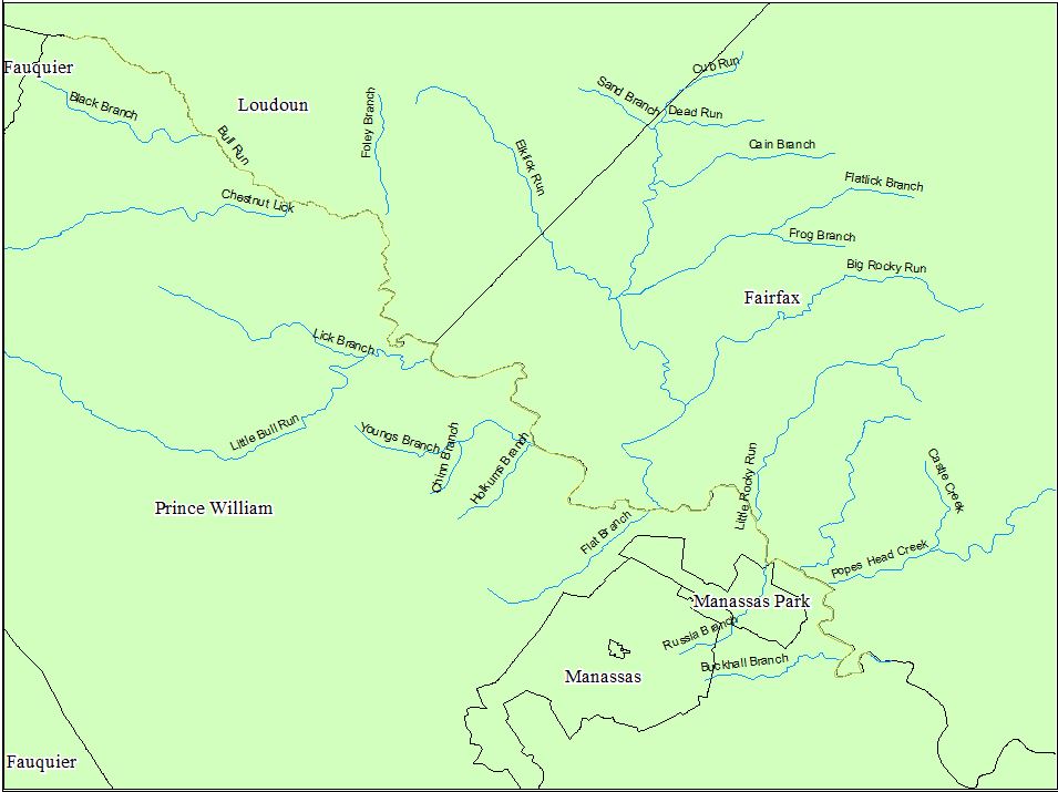
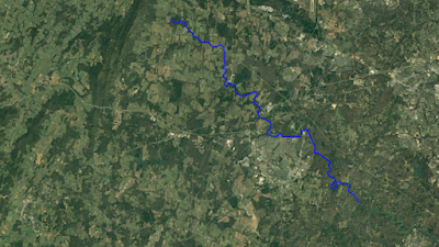
The Future of the Bull Run Watershed: An Overview By Stephen Bendele Bull Run Watershed Bull Run is perennial tributary that originates from the spring located at 630 feet above sea-level on Bull Run Mountain and flows 150,000 liner feet east to the Occoquan River 121 feet above sea level totaling a 509 feet change in elevation. Bull Run Watershed is part of the Middle Potomac-Anacostia-Occoquan (MPAO) watershed and includes five subwatersheds (Cub Run, Little Bull Run, Lower Bull Run, Middle Bull Run, and Upper Bull Run) totaling a watershed area of 50,059 hectares. One major benefits of streams is the removal of stormwater, however during storm events rivers, streams and even small tributaries can flood their banks and damage infrastructure and buildings. Federal Emergency Management Agency (FEMA) flood maps in order to identify areas pron to flooding and determine if land use decisions are properly considering flood risks. FEMA is an agency of t

FLOOD PLAIN, SOILS, AND LAND USE MAPS

Image
The Bull Run Watershed Bull Run, a perinatal tributary of the Occaquan river located in Loudoun, Prince William, and Fairfax counties, Virginia. The approximately 28 mile stream includes a watershed that covers approximately 50,000 hectares land. Streams are useful and beautiful natural resource features that provide a number of economic and ecological benefits. One major benefits of streams is the removal of stormwater, however during storm events rivers, streams and even small tributaries can flood their banks and damage infrastructure and buildings. This post will review Federal Emergency Management Agency (FEMA) flood maps in order to identify areas pron to flooding and determine if land use decisions are properly considering flood risks.      The 100 Year Flood FEMA  is an agency of the  United States Department of Homeland Security tasked with  coordinating  the response to a disaster that has occurred in the United States and that overwhelms the resources of loca

The Emerald Ash Borer

Image
INTRODUCTION      Agrilus planipennis commonly called the Emerald Ash Borer (EAB) due to the emerald green color of the adult beetle, and its life cycle which involves the boring into and out of ash trees ( Fraxinus sp.) . EAB was first discovered in Michigan in 2002, but is believed to have established a breeding population within the United States by 1990. Though no specific introduction site or vector it is believed that the EAB was introduced by commercial packing material by boat or plane. Today, EAB is found commonly throughout 35 states/provinces of the U.S. and Canada. Since its establishment and spread EAB has been responsible for the deaths of millions of ash trees and to a lesser extent the fringed trees. In response the U.S. and Canada are committed to stopping spread, managing infested areas, and maintaining healthy ash populations.   LIFECYCLE      The EAB life cycle is similar to that of many insects with individuals transitioning from egg, larva, pupa, to

IS MITIGATION A MYTH OR MIRACLE?

Image
Is mitigation a myth or miracle?      This week I wanted to research and discuss Mitigation as a tool for reducing the impact of development on water resources. Wetlands and streams are important parts of the watershed system. Yet, developmental needs can conflict with these resources, and when this occurs developers must find a way to meet their needs with the least impact to wetlands and streams. WHAT IS WETLAND MITIGATION?  Summary:       Wetland mitigation/compensatory mitigation is the reducing or negating the impact or destruction of aquatic and wetland systems through the creation new systems, enrichment of current systems, or restoration of previously impacted systems.  Wetland Mitigation: Clean Water Act       Mitigation is encompassed under section 404 of the Clean Water Act (CWA) compensatory mitigation. The act is an important part of the United States's protection of Waters of the United States (WOUS).  Like many environmental law the CWA is administra

Less development or smarter development?

Image
LEEDing The Way to Sustainability  The Developing Development Problem      Northern Virginia (NOVA) is subgroup of counties in Virginia that includes Fairfax, Prince William, and Loudoun Counties, and are often considered part of the Washington District of Colombia's metropolitan surroundings. These three counties along with a handful of cities such as Manassas, Reston, Arlington, and Alexandria account for roughly a half of Virginia's 8 million people according to the 2010 census. The areas population has increased since 2010 and the need to house and accommodate the the rising population has resulted in increased development in all counties and cities. The area surrounding Bull Run has experienced large growth with current estimates indicating a 15.9% increase in county population and a 16.5% and a 9.5% increase in Manassas city park, and Manassas city respectively. The primary problem with the large and rapid population growth is the dramatic loss of green spaces and p

Piedmont Environmental Council

This week I spent time researching local organizations working to promote the conservation and improvements of  watersheds. I wanted to spotlight the Piedmont Environmental Council. Click the link to find out more.

Flood and Drought Data

Floods and droughts can have significant negative impacts on watersheds. I took some time to review climate data, and noted a few major flood and drought events. Checkout the presentation in the link below: